Postcard #2
Tuesday, January 15, 2002
I left Puerto Montt on January 8, travelling south by bus on the
first stretch of the Carretera Austral. The road included a 30-minute
ferry crossing at the entrance to the Reloncaví Estuary,
between Caleta La Arena and Caleta Puelche. The road passes through
Contao, in the Huailahué region, through Caleta El Manzano,
terminating at Hornorpirén, also known as Río Negro.
The local volcano is called Antupirén.
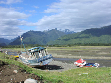
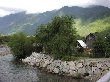
Hornopirén
Volcán Antupirén
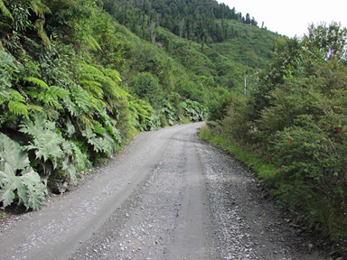
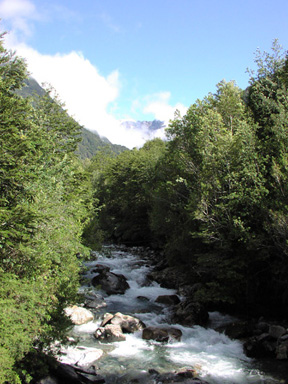
Carretera Austral
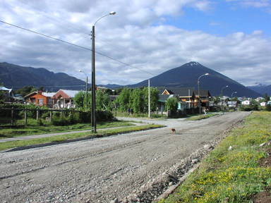
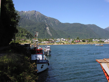
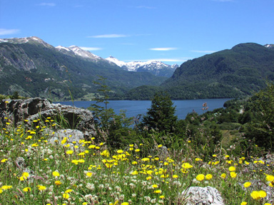
Puyuhuapi
Puyuhuapi
I was in Puyuhuapi, pop. 500, for 3 days. There is absolutely
nothing to do but walk around the fjord when it is dry, and read a
book when it rains. Delicious. The town was first settled by Germans
in the 1940s, and in 1945 they founded a rug factory. Their only
access was by boat from Puerto Montt, but the area attracted farmers
from Chiloé and others looking for new land to occupy and
raise their livestock. The rug factory, Alfombras
de Puyuhuapi, has an international reputation and clientele, and
produces fine handmade rugs with 20,000 knots per square meter.
Currently they employ seven local women to work the looms.
Much of the scenery reminds me of western Norway and Alaska.
Rainfall can average 3-4 meters annually. The highlight among many
was Queulat National Park. Imagine driving along a gravel road in
bright sunlight, with snow-covered peaks all around, and surrounded
by nalca and chilco (giant rhubarb and wild fuscia), an inpenetrable
jungle. We ascended the cuesta with 17 switchback curves from sea
level to 500 meters in just a few kilometers. Here is where the
Jesuit Padre García explored in 1766, searching for the
mythical City of Caesars. During this spectacular ride the music on
the bus radio lamented “Aun si tienes manos frías te
amaré” (Even if you have cold hands I will love
you).
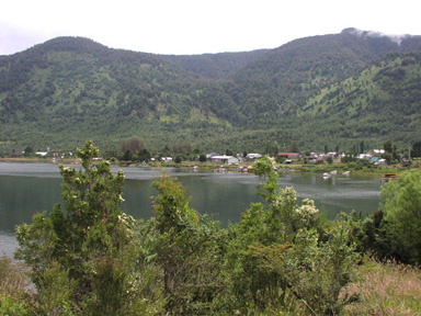
Pto. Cisnes is a village of 1800 inhabitants, most of whom work
in the local salmon farming industry. The town was settled in 1896
and has a beautiful setting on the fjord, facing the very large
Magdalena Island. On a clear and sunny summer day it is a most
beautiful town.
I left Cisnes to come inland and further south, to Coyhaique, a
bustling city of 51,000 on the eastern flank of the Andes, with pampa
stretching east to Argentina. Today is hot and dry. I was here last
in 1965 when it was a small village. The next bus south leaves in two
days, to Puerto Tranquilo (pop. less than 500) on the General Carrera
Lake, the second largest in south America.
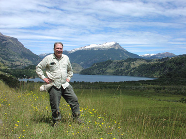
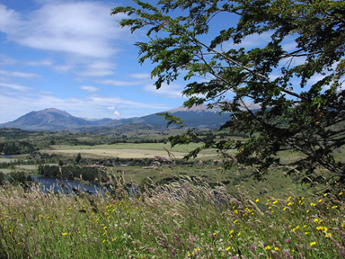
Lago Frío, near Coyhaique
Simpson Valley, near Coyhaique
Then it's on to Cochrane (Thomas Alexander Cochrane, 1775-1860,
defeated the Spanish in the Pacific, helped liberate Brazil,
otherwise loved war). Fifteen or twenty years ago there were only ox
cart and horse trails in this region. The roads will be paved in the
next few years, and we will probably see Japanese tour buses before
long.
Speaking of buses. The usual bus is a 14-passenger van. The
middle seats are fine, but the rear seat takes all the stones and
bumps. Only 2 people got sick today, one yesterday. Some drivers stop
to let us take pictures, but when it is filled with local Chileans,
they don't even make barf stops. The assistant just grabbed a kid,
put his head out the window, and told him to go for it.
This new road, the Carretera Austral, has become a boom for
tourism. It now stretches about
1,500 kilometers to Villa O'Higgins, latitude 48º 28', named for
the great liberator of Chile, Bernardo O'Higgens (1778-1842). Most of
it is unpaved, and parts of it are connected by boat.
I hope to get to Caleta Tortel, near the edge of a large ice cap.
Villa O'Higgins is too much trouble, as those final 100 kms take
about 7 hours, and the bus returns the next day. I'll wait for the
Japanese tour buses.
© 2003 Roger Emanuels